Map Picturesque map of the Surroundings of Paris
MX026659
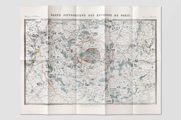
This map published in 1891, after the death of its author, the cartographic engineer Alexandre Vuillemin, creator of numerous internationally renowned atlases, is picturesque in that it combines the true work of a geographer, concerned with precision, networks and distances, with an affable presentation...
Read more
This map published in 1891, after the death of its author, the cartographic engineer Alexandre Vuillemin, creator of numerous internationally renowned atlases, is picturesque in that it combines the true work of a geographer, concerned with precision, networks and distances, with an affable presentation in the form of vignettes showing aristocratic homes scattered throughout a region which would seem to be solely focused on its reason for being : Paris, with 2,5 million inhabitants at the time.
Map
Folded size: 18,3 × 33,2 cm
Unfolded size: 85 × 68 cm
A card on the front, its story on the back
Bilingual French-English
Reliefs Éditions
Co-published with the BNF (The national Library of France)
Close
Sold by GrandPalaisRmn

